resource library
ArrayCooling and Greening Melbourne interactive map
30/07/2019
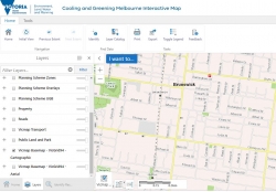
DELWP have recently completed a Victorian interactive Greening and Cooling Map and are currently seeking user feedback.
This tool brings together 2014 and 2018 vegetation, urban heat, and heat vulnerability data covering Melbourne’s urban areas. The data was prepared by RMIT University, CSIRO, and the Clean Air and Urban Landscapes (CAUL) Hub of the National Environmental Science Program.
The tool allows you search by address, suburb or local government area and provides information on location vegetation cover, urban heat and heat vulnerability.
Visit the Plan Melbourne webpage to access the map, a how to guide and answers to FAQs.