news
Rapid geospatial flood mapping in recent NSW floods
03 May 2021
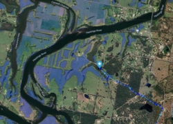
During the recent NSW floods, maps indicating flooded areas were rapidly developed in a 24-hour international effort to help the state’s regional and rural electricity network restore power as quickly as possible, while keeping crews safe.
Using geospatial data from satellites, a digital solutions business was able to create and integrate up-to-date maps of flooded areas for Essential Energy, so the company could better support crews on the ground.
Many people in the flood affected areas were facing challenges with power supply while network repairs were underway, and the companies needed to have an information exchange to ensure the expidiation of safe supply.
Read more on the Geospatial World website